

Ruta 32
From the Central Valley to the Caribbean
Ruta 32 is the highway from the capital, San José, to Puerto Limón on the Caribbean coast. This highway is the most practical route when traveling between the Caribbean and the Central Valley, and especially the part that goes through Braulio Carrillo National Park is impressive. This road, however, is also notorious for closures in times of heavy rains in the region. Here is what you need to know about ruta 32. Explore the road to the Caribbean side of Costa Rica!
Ruta 32
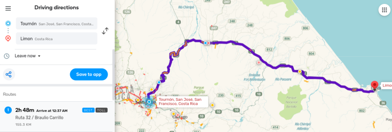
Ruta 32 is the highway between the capital, San José, all the way to Puerto Limón on the Caribbean coast. If you are planning on visiting Tortuguero or the South Caribbean, with Puerto Viejo de Talamanca, Cahuita, and Manzanillo, you will most likely be traveling down ruta 32 when you are coming from the direction of San José or vice versa. It is the main connection between the Central Valley and the Caribbean. The highway is 156 kilometers (ca. 97 miles) long and was inaugurated in 1987. Before that time, the main connections with the Caribbean side of the country were via ruta 10 through Turrialba or via ruta 126 through Sarapiqui.

Carretera Braulio Carrillo
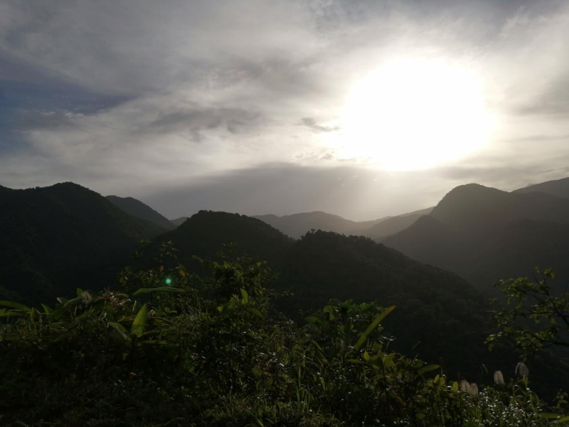
Ruta 32, or at least the first leg of the road, is also known as Carretera Braulio Carrillo, because this first leg and the most impressive part of the highway lead through Braulio Carrillo National Park. This part of the route is mountainous and mostly uninhabited. Imagine that you are visiting Costa Rica for the first time, and you have landed at Juan Santamaria International Airport. You have picked up your rental car and have departed to your first destination, which, in this case, is on the Caribbean side of Costa Rica. You have managed to make your way through the traffic-filled roads of the metropolitan area of San José and have turned onto ruta 32. After you have left the busy urban area behind, you now suddenly find yourself driving a highway through dense jungle and over mountain ridges with spectacular views over Braulio Carrillo National Park. That is truly a Pura Vida moment.

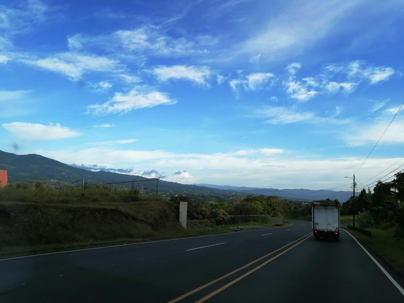
Credits for the photos of Ruta 32 at Zurqui and Braullio Carrillo: Familia Duarte Moya
Hay Paso por el Zurqui?
Besides that ruta 32 is known as Carretera Braulio Carrillo, the question 'Is there passage through Zurquí?' is also unmistakably related to this highway. First, what is Zurquí? Cerro Zurquí is a mountain peak located in Braulio Carrillo National Park, close to ruta 32. For ruta 32, a tunnel was constructed through the slope of Cerro Zurquí. This tunnel is carrying the name Túnel Zurquí, 'The Zurquí Tunnel.' Now, why is the question 'Hay paso por el Zurquí?' so relevant to this highway? Ruta 32 is beautiful and scenic, but the part through Braulio Carrillo National Park is also notorious for foggy conditions and being closed due to heavy rainfall and landslides.
Check Road Conditions
There are various Facebook groups dedicated to sharing information on the current situation of the highway, and the most common question from people ready to leave home is 'Hay paso por el Zurquí?'. If you are planning to use this highway during your stay in Costa Rica, you can join these groups. The ones that are proactively sharing details on road conditions are Ruta 32 Noticias, Radar 32, and Ruta 32 y su Estado.
Waze is also a popular navigation app in Costa Rica. With Waze, users can indicate issues they encounter on the road while navigating, such as accidents, traffic jams, etcetera. I recommend Waze as your navigation app when driving in Costa Rica. You can also check the current situation of a route on the Waze website. You can also check at your accommodation on the day of your departure if they know about any major issues, but their information might not be that up-to-date.
Ruta 10 via Turrialba
Fortunately, there are alternative routes if ruta 32 is closed. While most landslide issues on ruta 32 happen in the mountainous Braulio Carrillo part, there are alternative routes to avoid this first leg of the highway from the direction of San José. The most common one is ruta 10 through Cartago and Turrialba. After Turrialba the highway starts descending and joins ruta 32 at the town of Siquirres. In the area between Cartago and Turrialba there are many points of interest.
You might actually consider this route for that matter and stay in the Orosi Valley to visit the nearby Irazú Volcano National Park, Turrialba Volcano National Park, Tapanti National Park, Ujarras, and the Guayabo National Monument. Read all about it on The South Central Valley page.

What to Explore Next
Read more about driving in Costa Rica on the Traveling by Car page. You might also be interested in reading about the regions that are connected by Ruta 32: