

Volcanoes
During my time living in Costa Rica and the many times visiting in the years after, I have witnessed lava streams from the Arenal Volcano, the Turrialba Volcano becoming active, an earthquake while relaxing at home, and even small tsunamis once while lying on the beach of Santa Teresa and another during a trip to Isla Tortuga almost capsizing our boat. These impressive and humbling events are also inextricably linked to this wonderful country.
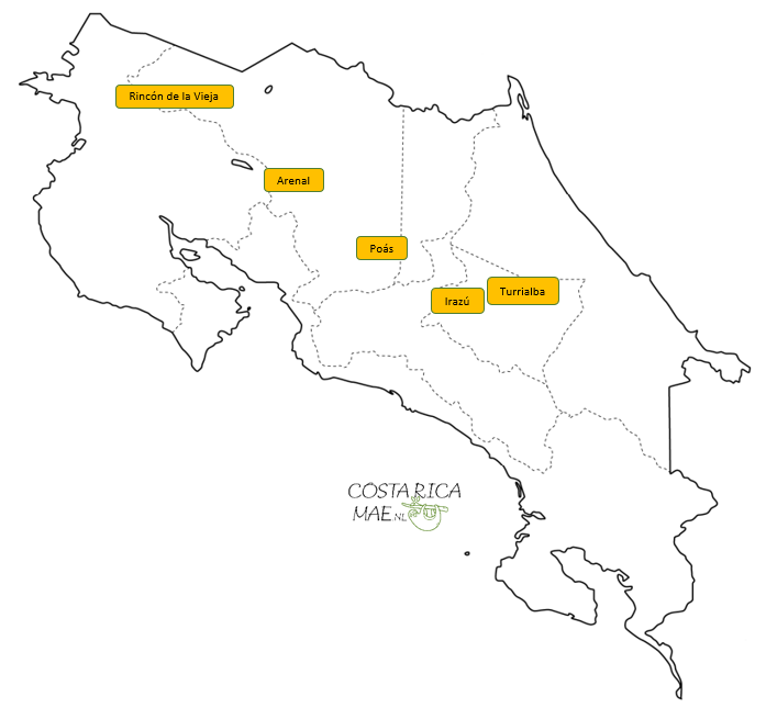
Costa Rica and Volcanoes
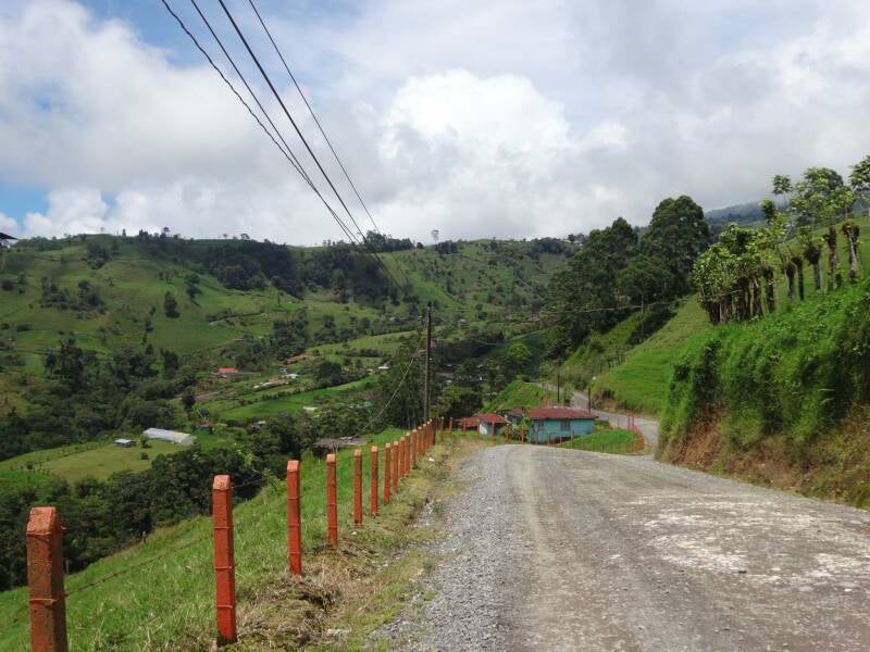
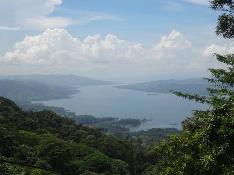
Costa Rica is home to majestic volcanoes that define the impressive mountainous landscapes of this beautiful country. These volcanic formations result from the tectonic activity, specifically the subduction of the Cocos Plate beneath the Caribbean Plate. The five most famous volcanoes in Costa Rica are Arenal, Poás, Irazú, Turrialba, and Rincon de la Vieja. Turrialba has been active for years but recently went back to rest, and the national park reopened for visitors, be it with a mandatory guide. Poás recently became active with frequent eruptions (during Q2 of 2025), and the national park has been closed for visitors. Rincon de la Vieja has been active now for a while with an occasional eruption, while the main sectors of the national park remain open as they are not under direct threat of the volcano. When you visit La Fortuna, you can see the iconic Arenal volcano from practically everywhere in the area. Visiting Rio Celeste? You are actually going to visit the Tenorio Volcano National Park.

Costa Rica is part of the Pacific Ring of Fire, a horseshoe-shaped zone known for its intense volcanic activity and frequent earthquakes, encircling the Pacific Ocean basin. This geological feature arises from the tectonic movements of the Earth's plates. In Costa Rica, the Ring of Fire manifests through its numerous active and dormant volcanoes, as well as geothermal activity that shapes the country's landscapes.
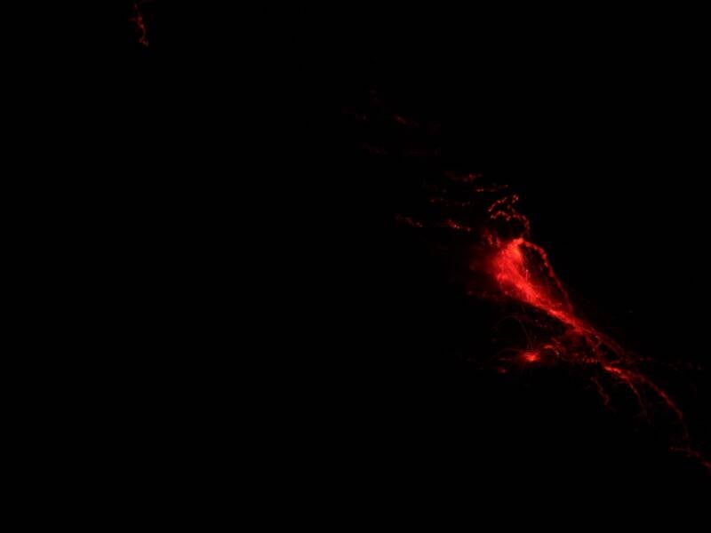
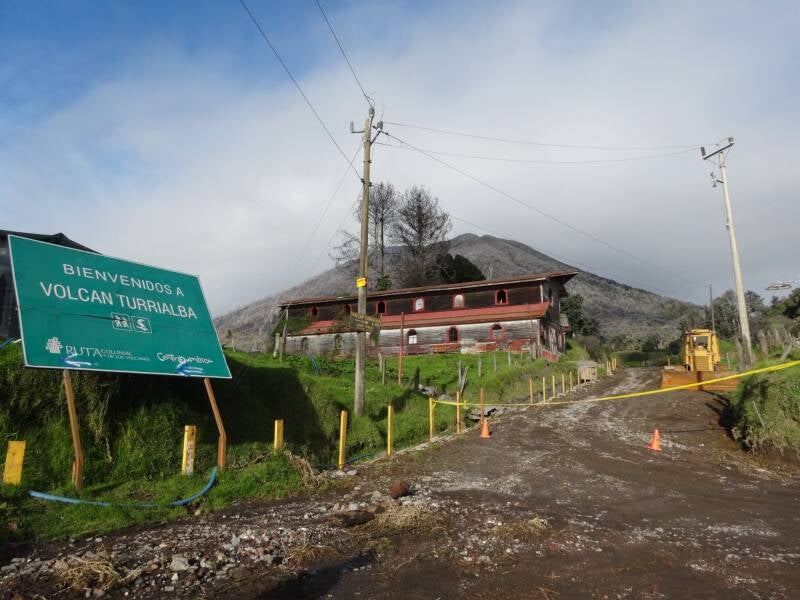
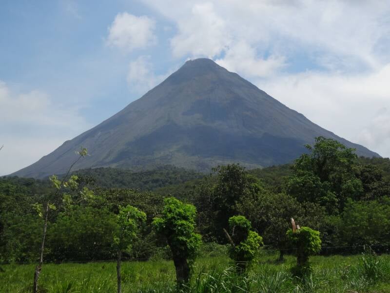
Besides ecotourism, Costa Rica is also well known for its agriculture. Volcanoes play a vital role in shaping the country's agricultural success. The volcanic soil, known as andosol, is incredibly fertile and rich in nutrients. This soil is particularly beneficial for cultivating coffee, a key export for Costa Rica. However, volcanic and tectonic activity also poses challenges, such as occasional eruptions and earthquakes. The pictures below show a recent eruption of the Poás volcano (2025), the Turrialba volcano (2010) and lava streams from the Arenal volcano (2009) which nowdays cannot be witnessed anymore.


OVSICORI-UNA
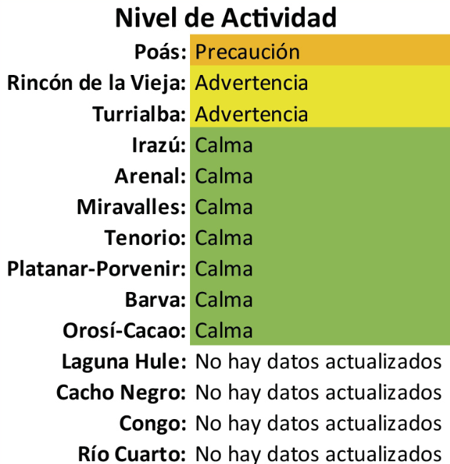
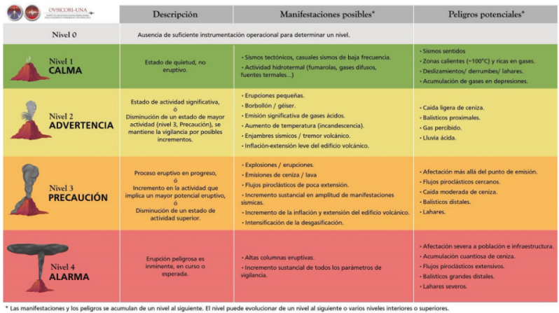
The Observatorio Vulcanológico y Sismológico de Costa Rica de la Universidad Nacional (OVSICORI-UNA), or, translated, the Volcanological and Seismological Observatory of Costa Rica, is a scientific institution dedicated to monitoring and studying the geological activity of Costa Rica. They play a crucial role in hazard mitigation efforts by providing continuous surveillance of its numerous volcanoes and seismic activity. They do this through a network of advanced monitoring stations collecting real-time data on things like seismicity, ground deformation, and gas emissions. With this data, they continuously assess and communicate the activity levels of Costa Rica's volcanoes, contributing to public safety and scientific understanding. They frequently update the status of the active volcanoes on their website: Actividad volcánica. As you can see in the example (dated April 2025) below, there are four levels to indicate the activity of a volcano.
The geological setting of Costa Rica leads to frequent seismic activity, with small tremors occurring almost daily and noticeable quakes happening several times a year. While most are minor, Costa Rica has experienced significant and destructive earthquakes throughout its history, such as the 1910 Cartago earthquake and the 1991 Limón earthquake, with a magnitude of 7.7. The country has implemented a seismological monitoring system, which also includes efforts of OVSICORI to help mitigate risks. On their website, you can see a map showing all earthquakes from the past 15 days.

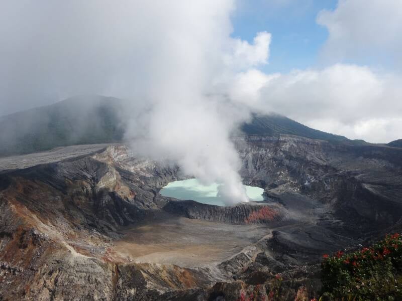
The Poás Volcano
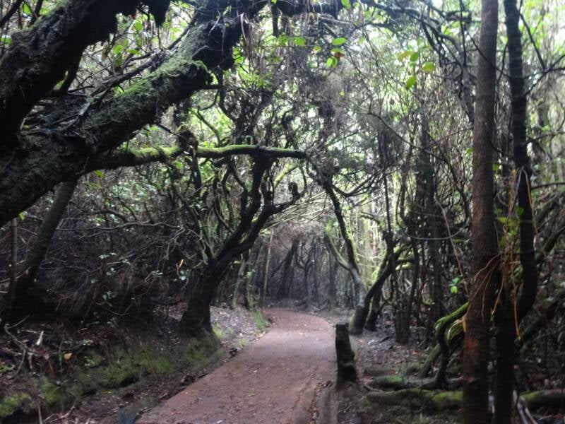
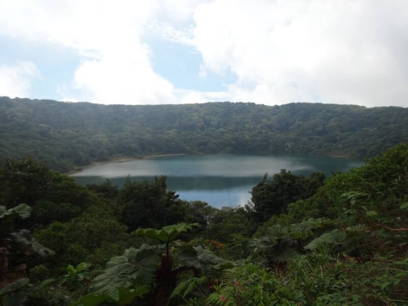
Poás Volcano National Park, located north of San José, is a popular and accessible destination centered around the active Poás Volcano, which stands at 2,700 meters (8,850 feet) and boasts a large, impressive crater. Beyond the main crater, the park offers a scenic hiking trail to Laguna Botos, an older, tranquil crater lake. Visitors must purchase tickets online for park access; both the main crater and the Laguna Botos trail are easily reachable from the parking lot, with the latter offering a glimpse of the volcano's unique vegetation. Explore the North Central Valley, where Poás is located.
The volcano's ongoing activity is evident in its hot, acidic crater lagoon, which acts as a geyser, occasionally producing small eruptions. Poás has a history of significant phreatic (steam-driven) eruptions. Notable past events include heightened activity in 1953-1954 with lava extrusion and ashfall and large phreatic eruptions in 1989-1990. Intense phreatic eruptions in 2017 led to the temporary closure of the park, and most recently again in 2025.
The Irazú Volcano
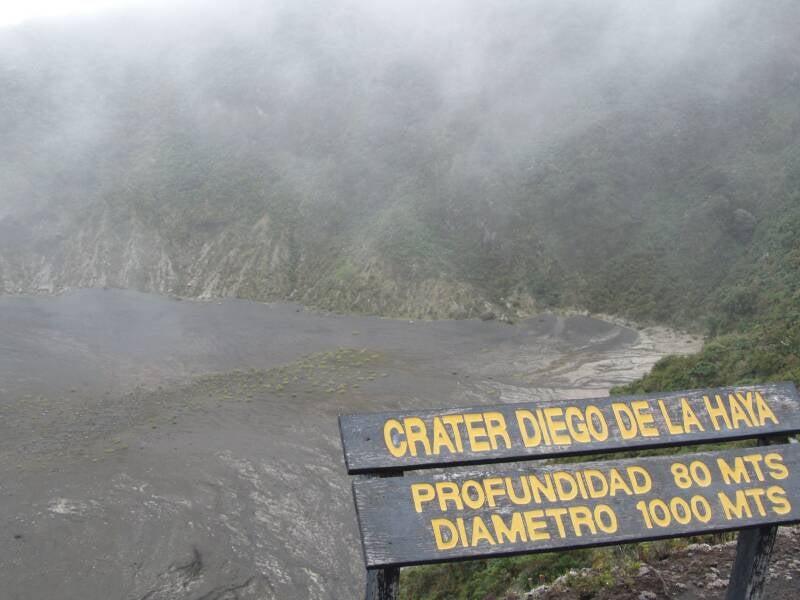
East of San José, near the city of Cartago, Irazú Volcano National Park boasts Costa Rica's highest volcano, Irazú, at 3,432 meters (11,260 feet). Its summit offers impressive crater views and, on clear days, a glimpse of both Caribbean and Pacific coasts, though the high-altitude weather is often cold and foggy. Beyond the main craters, the park's Prussia sector provides forested hiking trails and a viewpoint towards Turrialba volcano. Explore the South Central Valley, where Irazú is located.
Irazú also has a significant eruptive history, including records back to the year 1723 with the "Diego de la Haya" eruption, thereafter a prolonged period of activity from 1917 to 1920, and the impactful 1963-1965 period of activity with an eruption that caused extensive ashfall over San José and the Central Valley. Did you know that Cartago used to be the capital of Costa Rica? Due to a series of earthquakes in the 19th century combined with political factors, the more strategic and less vulnerable city of San José became the new capital.


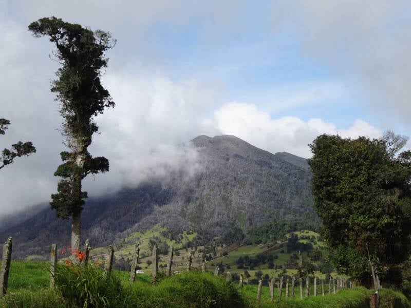
The Turrialba Volcano
Turrialba Volcano National Park, located near Paraíso and Turrialba, is a protected area rich in biodiversity and offering stunning views, dominated by the active Turrialba Volcano. Standing at 3,340 meters (10,958 feet), the volcano provides spectacular panoramas, potentially extending to the Caribbean coast and the Talamanca mountain range. It is said that the name Turrialba translates to "Turri-Alba," meaning something like "white tower" or "white column". Explore the South Central Valley, where Turrialba is located.
Turrialba has a history of significant eruptions. A major active period from 1864 to 1868 involved large ash explosions and incandescent rockfalls, blanketing the Central Valley with ash. The early to mid-20th century saw intermittent activity, but a dramatic increase occurred from 2014 to 2017, with numerous large ash eruptions forcing the closure of both Juan Santamaría International Airport and the national park for safety. Since late 2020/early 2021, the park has reopened, allowing guided morning hikes to the craters.
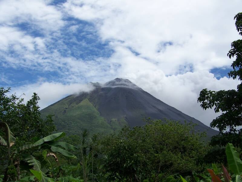
The Arenal Volcano
The Arenal Volcano is a popular tourist destination, particularly around the town of La Fortuna, from where you can see this impressive, conical-shaped giant. The region surrounding Arenal is rich in natural beauty, including hot springs, waterfalls, and diverse wildlife. The Arenal Volcano National Park, along with private reserves like Arenal 1968, offers numerous hiking trails that traverse old lava fields and secondary forests, providing views of the volcano and the surrounding landscape. You cannot go up the volcano itself. Explore the Northern Zone, where Arenal is located.
Arenal Volcano was famously active for decades, with its most significant eruptive period lasting from 1968 until 2010. The most important eruption occurred on July 29, 1968, when the volcano violently erupted after hundreds of years of dormancy and devastated the towns of Pueblo Nuevo and Tabacón. Afterward, during a long period of activity, it was possible to see fiery-red lava streams at night. However, since 2010, the volcano has been dormant.
What to Explore next
-
Now that you have read something about the volcanoes of Costa Rica, you might want to learn more about the different national parks on the National Parks page.